Sand River in NE Minnesota (Nature Conservancy Preserve)

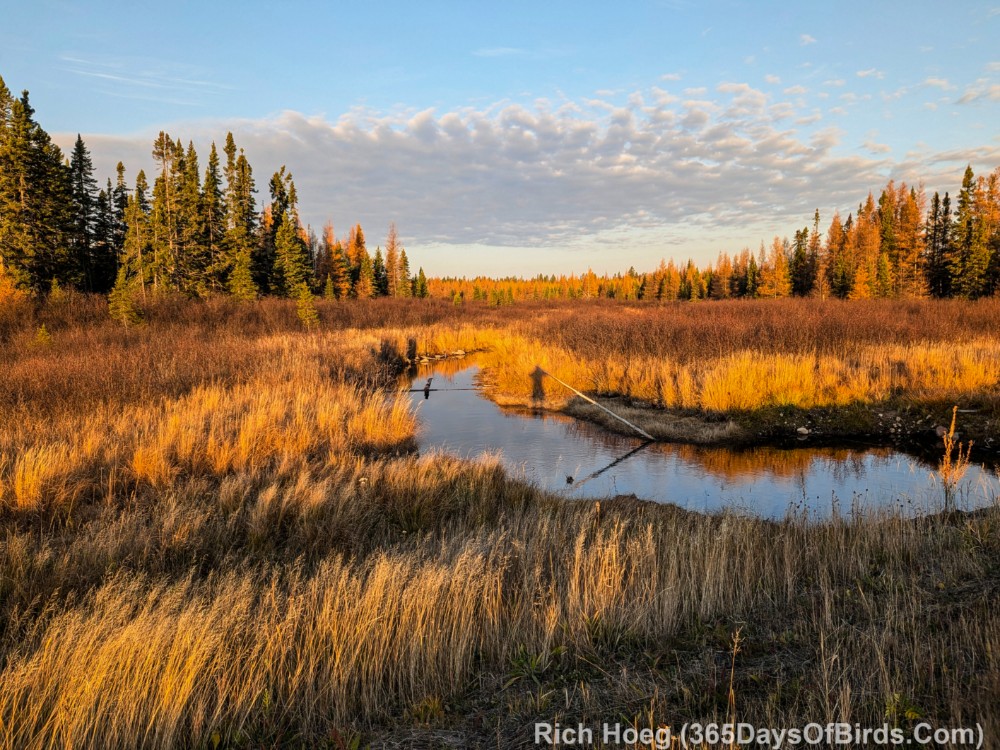
Folks who read my blog know I love the Sand Lake / 7 Beavers Nature Conservancy Preserve just a few miles distant from the Boundary Waters Canoe Area (BWCA). This special wilderness area is deep in the Superior National Forest. While almost 27,000 acres burned in the Greenwood Forest Fire, the wildlife including birds are charging back. I like to “hang out” in the Greenwood Creek region which is only 8 miles distant from the focus of today’s post, Sand River. To reach this area one drives inland from Two Harbors, Minnesota first via Lake County Highway #2 and then US Forest Road #15.

These images and video were taken shortly after sunrise on October 2, 2026.

Sand River Stretching South from the Highway


Sand River Stretching North from the Highway


The Highway Stretches North


In total I was at the Sand River Wayside (this location) for almost 30 minutes. Nary a car drove by me while I used my drone. As a reminder I do NOT use my drone for wildlife photography.

A Drone Tour of Sand River (video link for blog subscribers)


Repeated from this spring … Greenwood Creek. (video link for subscribers)

You should have noticed a lot more “green” in this video. The Greenwood Creek area never burned and of course … it was Spring!

Crisp Point Lighthouse Ring-Billed Gull

In life we need to occasionally pause and spend time with “the common place”. When it comes to birds and the Great Lakes Region, I doubt there are gulls which are much more common than the Ring-Billed Gull. While we all watch these birds, do we often take the time to really observe our less exotic feather friends?

Late last week after a week of sleeping on the ground, I was tired and a bit cold Temperatures upon exiting our sleeping bags and tent each morning were in the high 30’s. Thus, I grabbed my camp chair, bundled up and sat on a remote Lake Superior Beach for over 45 minutes in the bright morning sun. My “sit” accomplished two things:

  • I warmed up!
  • I watched a Ring-Billed Gull fishing for its breakfast from a jetty

I hope you enjoy images of the “common place”. Nature is beautiful / enjoyable if we take the time to observe.

Sunrise – Sunset – Crisp Point Lighthouse, U.P., Michigan

13 years ago Molly and I first drove to this remote lighthouse on of far eastern shores of Lake Superior. Crisp Point Lighthouse is located 13.5 miles shy of Whitefish Point, and the Edmund Fitzgerald suck years ago (1975) in the open waters of Lake Superior opposite this light (not viewable from very far off shore). The light is reached via a 19 mile long dirt road, and each season we love taking a turn as lighthouse keepers. Only keepers may camp out of the light … there is no lighthouse keeper’s residence. Over the years we have been privileged to volunteer Molly and I have met a HUGE number of nice guests while taking care of our duties. It has been fantastic to share this little bit of paradise with other folk. Here are my other Crisp Point Lighthouse posts … from rainbows to the Northern Lights!

This year was a true gem. Here are a few photographs from this year’s visit. We arrived in about one week ago, and the combination of fall foliage colors with days having nary a cloud plus highs around 60 could not have been better. At night we would fall asleep in our tent with the waves of Lake Superior (only 25 yards distant) providing white noise. Thus … Sunrise to Sunset. In the second image you will see our small tent! Molly arrived back home last night in the Duluth area on the far western end of Lake Superior.

45 Minutes Before Sunrise

20 Minutes Before Sunrise


Sunset in a few minutes …

15 Minutes After Sunset

25 Minutes After Sunset